


Sandlapper Voting District, Richland County, South Carolina
About
Outline

Summary
| Unique Area Identifier | 666565 |
| Name | Sandlapper Voting District |
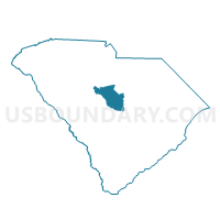
| County | Richland County |
| State | South Carolina |
| Area (square miles) | 3.15 |
| Land Area (square miles) | 3.15 |
| Water Area (square miles) | 0.00 |
| % of Land Area | 100.00 |
| % of Water Area | 0.00 |
| Latitude of the Internal Point | 34.15948430 |
| Longtitude of the Internal Point | -80.94418700 |
Maps


Graphs
Select a template below for downloading or customizing gragh for Sandlapper Voting District, Richland County, South Carolina


Neighbors
Neighoring Voting District (by Name) Neighboring Voting District on the Map
- Killian Voting District, Richland County, SC
- Longcreek Voting District, Richland County, SC
- Rice Creek Voting District, Richland County, SC
- Valley State Park Voting District, Richland County, SC
Top 10 Neighboring County Subdivision (by Population) Neighboring County Subdivision on the Map
Top 10 Neighboring Unified School District (by Population) Neighboring Unified School District on the Map
Top 10 Neighboring State Legislative District Lower Chamber (by Population) Neighboring State Legislative District Lower Chamber on the Map
- State House District 79, SC (59,129)
- State House District 77, SC (45,080)
- State House District 76, SC (35,411)